
Vflo Flood Forecast Model is now integrated into AEM Elements® 360
Vflo creates a hydrological model of your specific area that tells you exactly where water is going to go during a storm. That enables you to visualize the entire flood risk management cycle–before, during, and after a major storm.
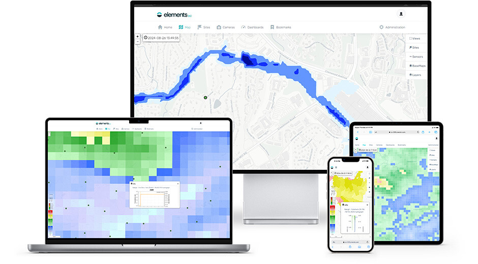
Easily integrate all forecast, sensor, and third-party data together in AEM Elements 360 to create a single, collaborative flood forecasting and early warning decision support command center.
Integrates watershed hydrology and hydraulics to generate discharge, stage, and mapped inundation within a single application.
Designed for use with gridded rainfall inputs, including GARR, for a more complete understanding of complex watershed processes.
Provides gridded and rate-driven runoff from both groundwater and surface water for increased accuracy.
Solves multiple hydrology water balance components for each grid cell, including infiltration rate excess, saturation excess, subsurface runoff, evapotranspiration, and soil moisture.
The Vflo hydraulic approach to hydrology allows stage, discharge and inundation to be simulated within a single model. Hydrologic input comes from radar rainfall or rain gauge data. Setup uses geospatial data. Vflo can leverage floodplain regulatory models to improve understanding of watershed processes. Wizard functionality offers automated DEM processing and produces digital cross-sections.
Vflo is a gridded, physics-based hydrologic model that simulates stormwater runoff based on geospatial data to model interior locations in the drainage network. It applies from major river basins to small catchments. The same modeling framework is used to develop detailed drainage infrastructure design, or for real-time forecasting of rainfall runoff and flooding. Flow rates, stage and inundation are simulated or predicted on the desktop and in real-time.
Summary features include:
- Fast and efficient simulation
- Models the hydrologic cycle for the entire watershed
- Generates flow/stage and inundation
- Leverages the spatial variability of the geospatial data – terrain and rainfall
- Designed for use with radar rainfall
- AI/ML Genetic algorithm: sensitivity analysis and continuous modules support model calibration